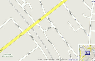
 Google Maps has made a major update on Estonian and Lithuanian map data. Road and railway networks, forest areas, water bodies, place names and urban areas have been updated all over the countries. On all major cities are now street networks with name labels and directions that makes possible road navigation. Also green areas with names have been added to the map in those cities.
The data is claimed to be provided by TeleAtlas. Data seems to be two, three years old (e.g. Raadimõisa).
In Latvia only Riga seems to be updated with street level and railway data.
Still, at the moment, the update doesn't expand to maps created with Google Maps API so you can use it only on http://maps.google.com.
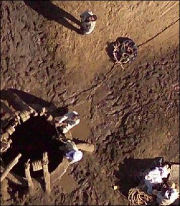
Also it's quite interesting that Google Maps has started to publish some aerial images with super zoom levels (by default zoom bar allows maximum zoom level 13, but some areas have now up to 23). Question of privacy? Google has been using also their own planes for aerial images.
1 kommentaar:
it was very interesting to read. I want to quote your post in my blog. It can? And you et an account on Twitter?.
Postita kommentaar