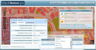
First look and feel is quite good, but it's really still a beta ;-)
Also listen to the podcast at the same topic.


Microsoft’s Virtual Earth mapping platform featuring roadmaps, satellite and aerial imagery, plus bird’s eye and 3-D views will be available for Maporama Intl corporate customers. They will benefit from increasingly innovative and complete solutions to meet their business needs: geolocalization, business intelligence, geomarketing, and mobility. Read the press release...


Statistics of usage of flash player versions:
http://www.adobe.com/products/player_census/flashplayer/version_penetration.html
http://www.adobe.com/products/player_census/flashplayer/
- Map sharing: Maps are kept in sync (in real time) between users involved in a collaboration session.
- Videoconferencing (Webcam sharing and VOIP): You can share your Webcam and microphone to add video and audio to your collaboration session.
- Whiteboarding: Collaborating users can draw on the map. For example you could draw potential directions, etc. The users’ whiteboards are kept in sync in real time.
- Cursor sharing: When you move your mouse, other users see the movements of your mouse and what you are pointing at.
Look at the demo here (username 'quest' worked well)

