28. apr 2008
Easy way to GIS
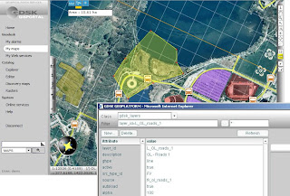
This "Easy Way to GIS" seems to be our MapCat PRO competitor: there's less flexibility for IT integrators etc but much more GUI (ready product, "MI Professional" in web). See also GDSK Geoplatform Introduction (PDF)
21. apr 2008
Whereyougonnabe
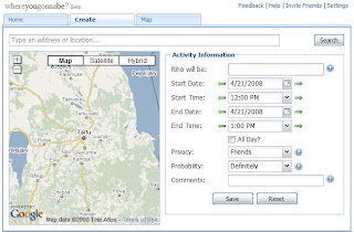
Whereyougonnabe application has now gone live, Facebook account users can try it out here. Read more information about the application at our founder Peter Batty's blog (announcement and review).
Whereyougonnabe is a service which enables you to geocode and save locations where and when you will be doing things in the future (where you gonna be?), also you can see when your friends will be close to you. You can view information on Google maps in both in a browser and using Google Earth.
Whereyougonnabe is a service which enables you to geocode and save locations where and when you will be doing things in the future (where you gonna be?), also you can see when your friends will be close to you. You can view information on Google maps in both in a browser and using Google Earth.
18. apr 2008
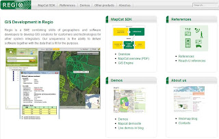
GIS microsite of Regio
Now information about our products, services, demos, references etc also available through GIS microsite at www.regio.ee/gis.
...and demos directly:
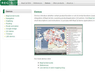
...and demos directly:

16. apr 2008
Google Earth gets next major update
The Google Earth Blog has produced video highlighting some of the newly added features like streetview, day/night lighting effects, faster loading 3d buildings and more in Google Earth 4.3. 
2. apr 2008
Dual maps
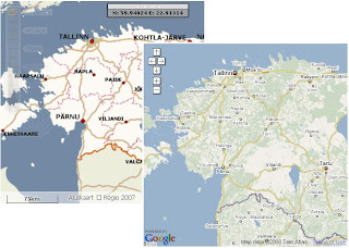
Our demo of Google Bridge combined Regio's and Google's maps. Dual maps lets you display side-by-side for a single location and combines the features of Google Maps and Microsoft Virtual Earth Maps within one embeddable control.
Google Bridge
For LBS demos we often need clobal content, more and more often "for tomorrow" and sometimes for very exotic and unexpected regions. It's not possible to integrate Navteq, Leaddog or TeleAtlas data into our GIS Engine with such short notice thus we created Google Maps support into MapCat. Google Bridge covers basic GIS functionalities (navigation, search, routing) and enables to use MapCat search, routing and light digitizing components in combination with GM (show adresses, POI's, routing results, geofences on top of the maps etc).
See also:
- Routing demo
- WMS demo
- GC Admin demo
Google Bridge is also useful for our webmap customers in Baltics who're willingly ready to pay for internetmap applications but not monthly fees for the maps (and for whom maps quality is not critical issue :-)
See also:
- Routing demo
- WMS demo
- GC Admin demo
Google Bridge is also useful for our webmap customers in Baltics who're willingly ready to pay for internetmap applications but not monthly fees for the maps (and for whom maps quality is not critical issue :-)
3D in Google Maps
The guys behind the Digital Urban blog obviously don't think that Google Maps are pretty enough because they have created an undeniably beautiful 3d map of the London Underground.
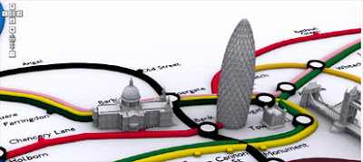
The map was created using CASA's free Image Cutter software, which helps create maps from any image.
This tube map doesn't include any real-time tracking of trains or fancy search facilities, in fact it isn't actually much use in helping you find underground train stations. In this instance it is a case of being just a pretty face.
Via googlemapsmania
Tellimine:
Postitused (Atom)