Cartifact announced that their map design work is prominently featured in the recently released version of Yahoo! Maps worldwide. The goal of the project was to create a style distinct from other web maps, in both visual appeal and content. Yahoo! officially launched the new map styles on May 16.
Also it seems Yahoo has given up of using DeCarta map engine...
23. mai 2007
18. mai 2007
Search from radius
Quite fancy solution of map UI for typical problem of search from radius. Based on google maps, but that's besides the point.
http://www.properazzi.com/
http://www.properazzi.com/
16. mai 2007
28. apr 2007
Chat, pictures, locate friends
Some nice ideas how to build GUI for FriendFinder and make map more attractive and interactive:
...RadiusIM combines IM with location. It’s the only site that shows you where your friends are hanging out and lets you surf for other people based on location. It supports all the major networks: MSN, AIM/ICQ, Yahoo, and GTalk/Jabber. And you can use radiusIM from anywhere because there are no downloads.

See also another idea how to make website more flexible and customizable here and ideas for implementation here.
...RadiusIM combines IM with location. It’s the only site that shows you where your friends are hanging out and lets you surf for other people based on location. It supports all the major networks: MSN, AIM/ICQ, Yahoo, and GTalk/Jabber. And you can use radiusIM from anywhere because there are no downloads.
See also another idea how to make website more flexible and customizable here and ideas for implementation here.
26. apr 2007
Google Maps update in Baltic States
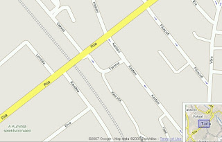 Google Maps has made a major update on Estonian and Lithuanian map data. Road and railway networks, forest areas, water bodies, place names and urban areas have been updated all over the countries. On all major cities are now street networks with name labels and directions that makes possible road navigation. Also green areas with names have been added to the map in those cities.
The data is claimed to be provided by TeleAtlas. Data seems to be two, three years old (e.g. Raadimõisa).
In Latvia only Riga seems to be updated with street level and railway data.
Still, at the moment, the update doesn't expand to maps created with Google Maps API so you can use it only on http://maps.google.com.
Also it's quite interesting that Google Maps has started to publish some aerial images with super zoom levels (by default zoom bar allows maximum zoom level 13, but some areas have now up to 23). Question of privacy? Google has been using also their own planes for aerial images.
23. apr 2007
Thematic map for QVIZ
This is our first prototype for QVIZ - map application capable of drawing thematic maps about time-spatial distribution of digitized historical documents. Polygon color refers to amount of items (historical resources) within search result. Developers can use map as a search filter/faceted query component (specify search by map parameters: bounding box, selected ploygon etc).

21. apr 2007
Animation examples
Some sexy examples about animation:
http://www.alexisparkinn.com/photogallery/Videos/2006-5-5_FedExDiversions.wmv
http://www.alexisparkinn.com/photogallery/Videos/2006-10-21-FAA-just-plots].mov
http://www.alexisparkinn.com/photogallery/Videos/2006-10-21-FAA-sees-USA.mov
http://www.alexisparkinn.com/photogallery/Videos/2006-5-5_FedEx_25HR_OPS.wmv
12. apr 2007
Google maps mashups
Google maps real-time tracking
Helsinki public transport mashup takes the locations of buses and trams in the Helsinki City transport network and plots their real-time location to a Google Map for you to watch, live!

Click on the vehicle and and the info-window gives you the option to show the route this it's traveling, plot the stops and also center the map on that bus/tram as it makes its way around the city. Watch the times to each stop as well. It's an invaluable tool to Helsinkians or tourists, as well as fun and addictive to watch for the rest of us! Very nicely done! [Via GoogleMapsMania]
Google Mapplets: Mashups Of Mashups
Trulia Hindsight
Helsinki public transport mashup takes the locations of buses and trams in the Helsinki City transport network and plots their real-time location to a Google Map for you to watch, live!
Click on the vehicle and and the info-window gives you the option to show the route this it's traveling, plot the stops and also center the map on that bus/tram as it makes its way around the city. Watch the times to each stop as well. It's an invaluable tool to Helsinkians or tourists, as well as fun and addictive to watch for the rest of us! Very nicely done! [Via GoogleMapsMania]
Google Mapplets: Mashups Of Mashups
A new feature in Google Maps, Mapplets, places data overlays onto your map - like movie times, crime rates and real estate prices. Mapplets just makes different mashups available on Google Maps proper, instead of having to go to another site to see them.
Trulia Hindsight
Trulia Hindsight is an animated map of homes in the United States from Trulia. The animations use the year the properties were built to show the growth of streets, neighborhoods and cities over time. View the map »
Google Maps Street View
Google launched a new feature for Google Maps that will include a street-level view. Good way to make street level maps useful as well as impressive to look at.
It's cool to virtually drive down the street,to search for driving directions, and then actually see the route before getting in the car. See also Google Maps Street View promotional video:
Windows Live Street View literally puts in in the drivers seat — though you have to admit it’s kinda crappy and appears to have been abandoned.
11. apr 2007
FF designed by Art School
Yesterday we had opportunity to have a closer look at concepts and designs of GUI-s from Art School students for our product named Friendfinder. To be honest, presentation of ideas and implementation was something we even couldn't expect, otherwords impressive!

New prototype for friendfinder is part of R&D project with acronym GISSER (GIS Server for Animation) funded by Enterprise Estonia. Read more...
New prototype for friendfinder is part of R&D project with acronym GISSER (GIS Server for Animation) funded by Enterprise Estonia. Read more...
Sharing Data Visualization
IBM is showing that there's more to the social Internet than just sharing pictures and video clips. The company has launched a new website, called Many Eyes, with the hope of adding a social aspect to data visualizations like maps, network diagrams, and scatter plots. Already the site is being used by everyone from Bible researchers to college professors. Read more...
Many Eyes visualization gallery
Selection of Technology Review

Many Eyes visualization gallery
Selection of Technology Review
Tellimine:
Postitused (Atom)